

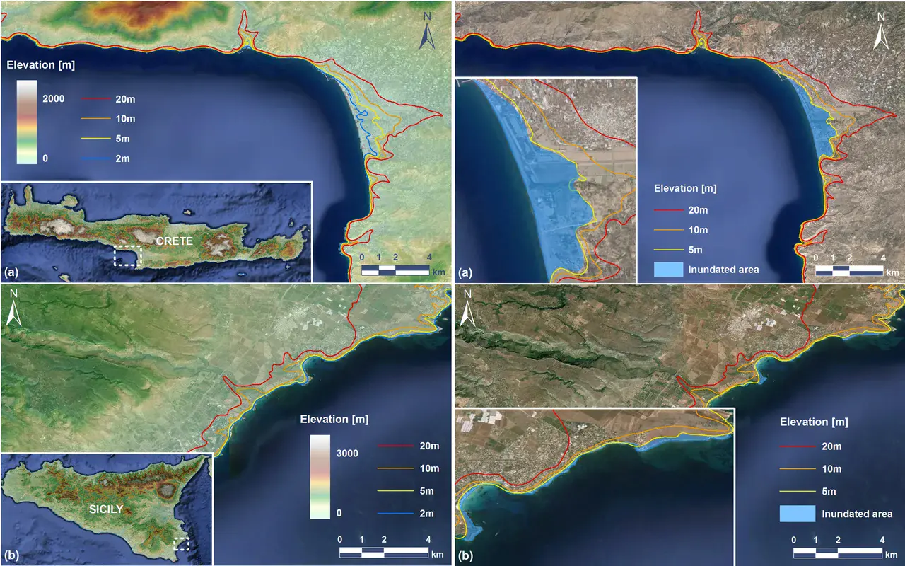
Elevation maps and areas inundated by the studied tsunamis
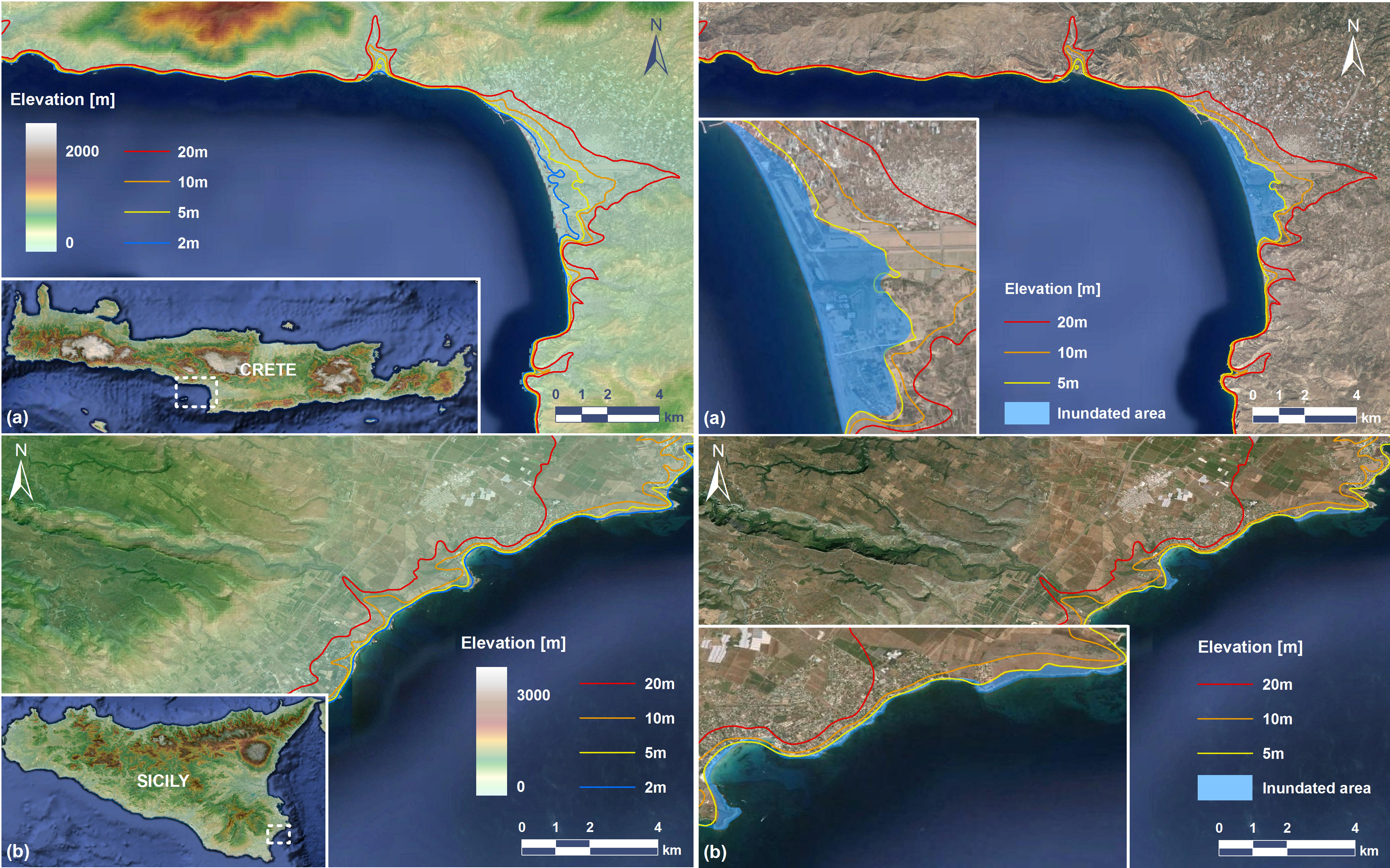
The maps on the left-hand side show the location and elevation of the low-lying coastal areas in south-southwest Crete (top) and in east-southeast Sicily (bottom). The ones on the right show the areas in these two locations that would be inundated in the earthquake-induced tsunami scenarios studied. The coloured lines are terrain-elevation contours.
Credit: Samaras et al., Ocean Science, 2015; base images from Google Earth, 2015
Related EGU articles
- What would a tsunami in the Mediterranean look like? (27 August 2015)
Download
- Original image (5.7 MB, 3780.0x2362.0 px)
- Preview image (143.1 KB, 1280x800 px, JPEG format)