

Virtual water network of the Roman world
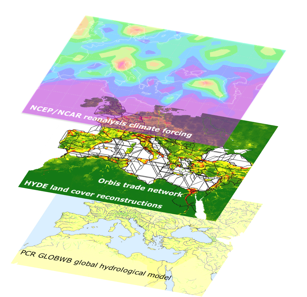
To create a virtual water network of the Roman world, the researchers used a hydrological model to calculate grain yields (bottom panel), which vary depending on factors such as climate (top panel) and soil type. The team also used reconstructed maps of the Roman landscape and population to estimate where agricultural production and food demand were greatest, and they simulated the trade in grain based on an interactive reconstruction of the Roman transport network (central panel).
Credit: Dermody et al., Hydrology and Earth System Sciences, 2014
Related EGU articles
- Water’s role in the rise and fall of the Roman Empire (11 December 2014)
Download
- Original image (749.0 KB, 1043.0x1008.0 px)