

Satellite image of the study region in the Karakoram
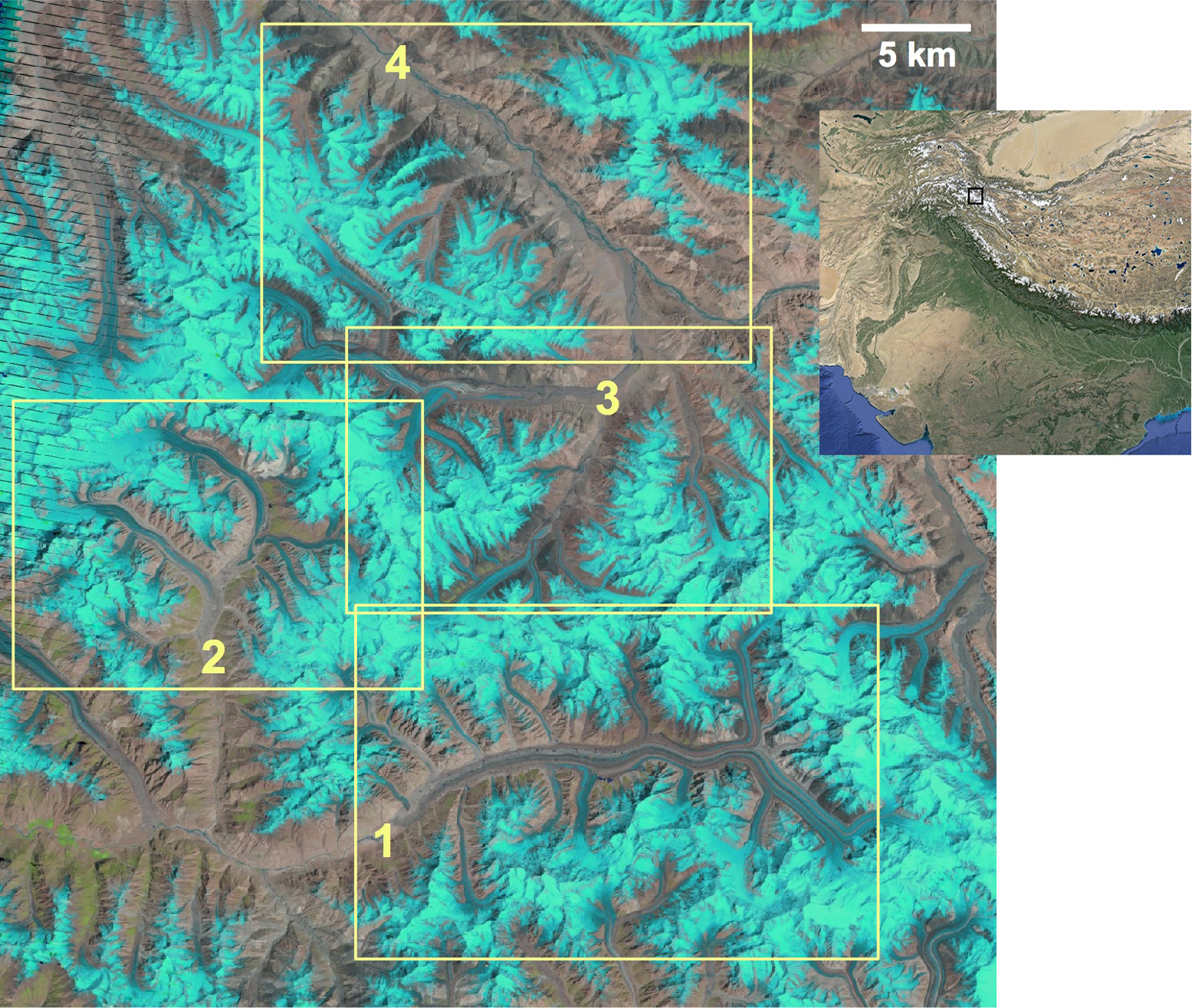
Satellite image, acquired by Landsat in 2004, of the central Karakoram. Frank Paul produced animated image sequences for the four regions inside the yellow rectangles: Baltoro (1), Panmah (2), Skamri–Sarpo Laggo (3), and Shaksgam (4). The black square in the inset shows the location of the study region in the Karakoram mountain range (map taken from Google Earth). The image centre is at 36 N, and 76.3 E. The black lines on the left of the image are related to an instrument failure on Landsat in 2003.
Credit: F. Paul, The Cryosphere, 2015 & USGS/NASA & Google Earth
Related EGU articles
- Revealing glacier flow with animated satellite images (26 November 2015)
Download
- Original image (930.2 KB, 1555.0x1315.0 px)
- Preview image (255.6 KB, 1280x1082 px, JPEG format)