

3D visualisation of Mt Isto based on fodar data
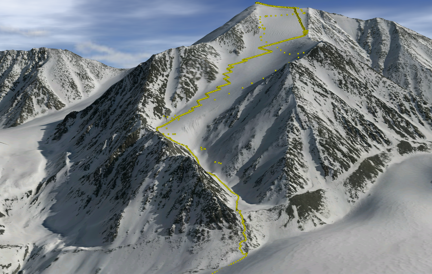
Mt Isto, the tallest peak in the US Arctic, shown as a 3D visualisation of fodar data. Yellow dots indicate position of some of the ground control GPS data collected during the climbing expedition. Closely spaced points are on the climb up, widely spaced points are on the ski down.
Licence: This image, published in a The Cryosphere paper, is licensed under a Creative Commons Attribution 3.0 Licence.
Credit: Nolan & DesLauriers, The Cryosphere, 2016/Fairbanks Fodar
Related EGU articles
Download
- Original image (2.1 MB, 1437.0x912.0 px)
- Preview image (130.3 KB, 1280x812 px, JPEG format)