

Harvey rainfall map overlaid onto a map of the Netherlands to illustrate the size and extent of the flooding
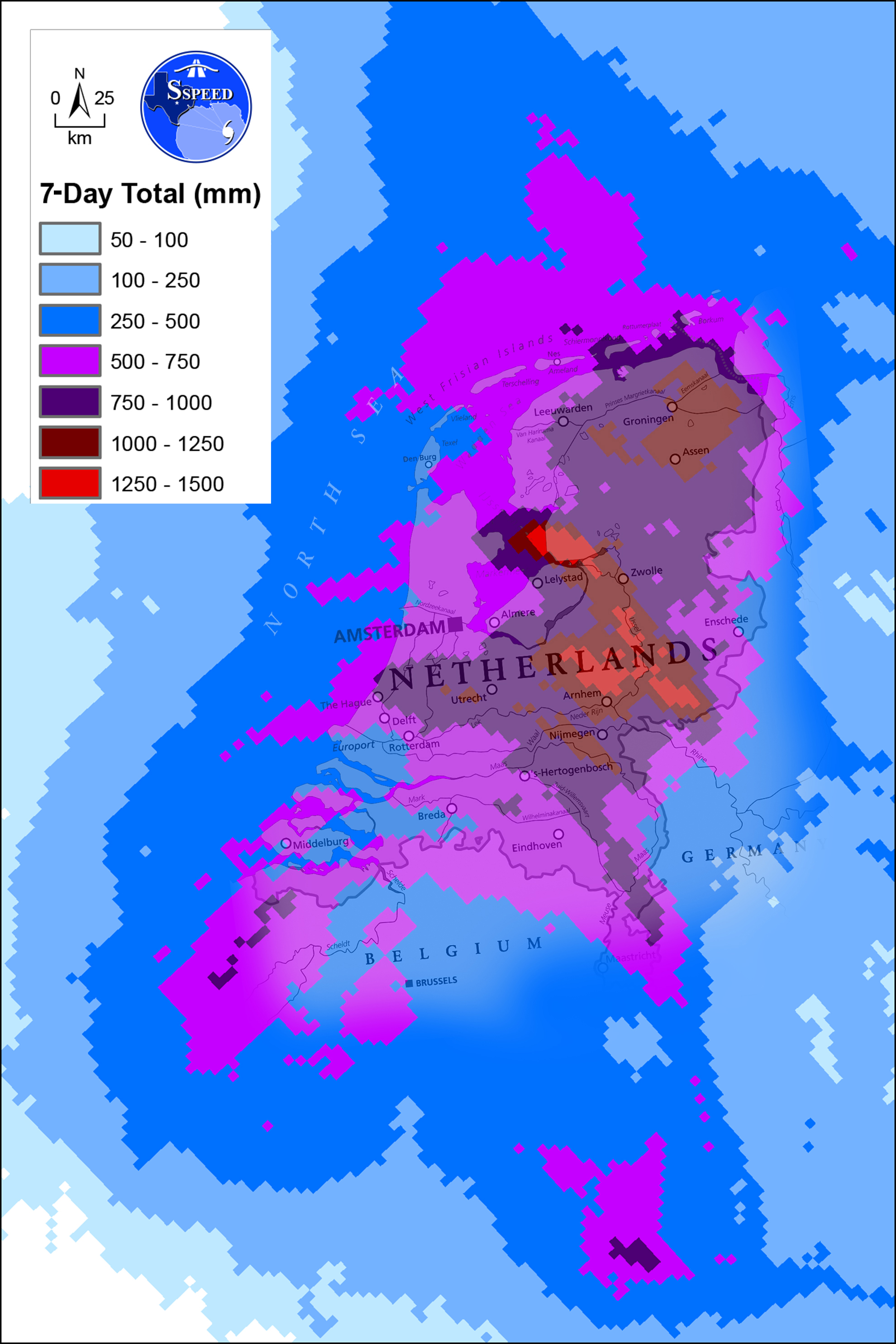
A map of the Netherlands illustrates the size and extent of flooding rains from Hurricane Harvey, an August 2017 tropical cyclone that inundated southeast Texas. Harvey's highest recorded rainfall of 1539 mm (60.58 inches) was in Nederland, Texas.
Credit: SSPEED Center/Rice University
Related EGU articles
- Hurricane Harvey: Dutch-Texan research shows most fatalities occurred outside flood zones (19 April 2018)
Download
- Original image (1.6 MB, 1980.0x2970.0 px)
- Preview image (112.8 KB, 1280x1920 px, JPEG format)