

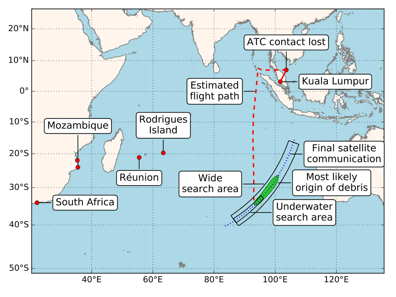
Figure 1: MH370 debris location and most likely origin compared to current underwater search area
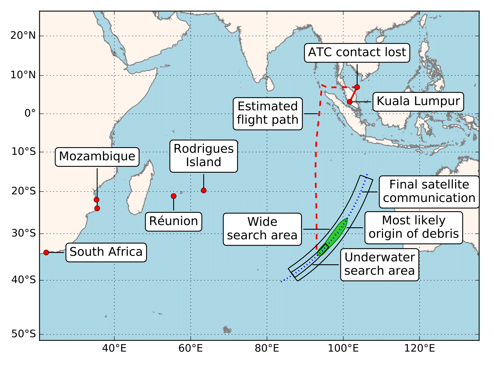
Diagram showing the estimated flight path of MH370 (in red) based on military radar and satellite data analysis, as well as the current underwater search area (smaller rectangle) and the region (in green) where new research indicates the wreckage is most likely to be. The green area in the map marks the location where the five confirmed debris found so far (also marked in the image) are most likely to have originated from.
Modified from Figure 1 of Jansen et al., Nat. Hazards Earth Syst. Sci (2016) by the lead author of the paper.
Credit: Jansen et al., Nat. Hazards Earth Syst. Sci (2016)
Related EGU articles
- New study reveals where MH370 debris more likely to be found (27 July 2016)
Download
- Original image (267.8 KB, 1600.0x1200.0 px)
- Preview image (77.8 KB, 1280x960 px, JPEG format)