
New satellite-based algorithm pinpoints crop water use
20 March 2020
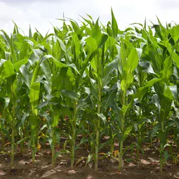
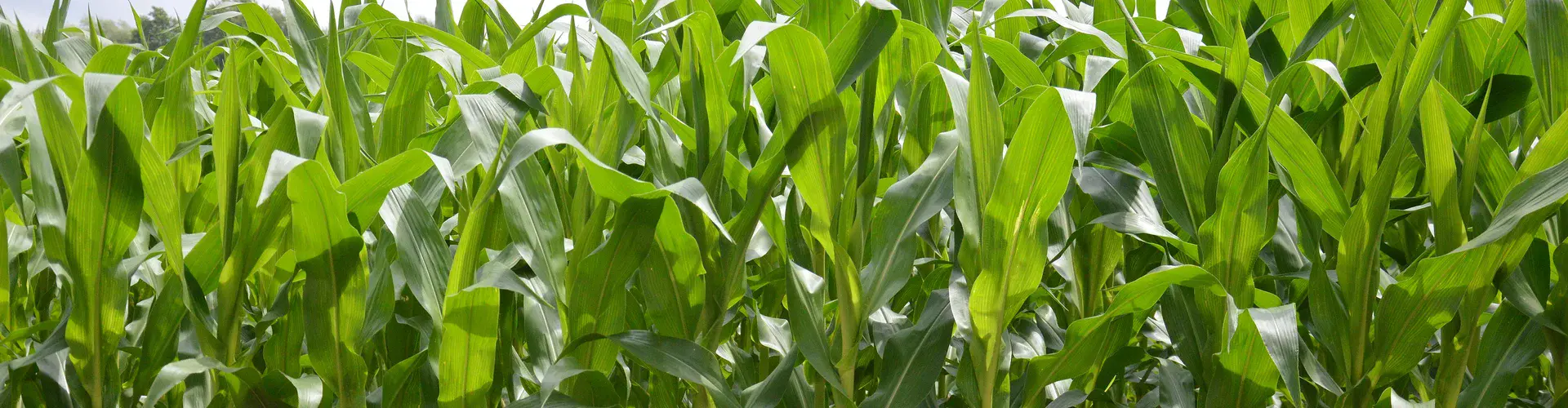
The growing threat of drought and rising water demand have made accurate forecasts of crop water use critical for farmland water management and sustainability. But limitations in existing models and satellite data pose challenges for precise estimates of evapotranspiration — a combination of evaporation from soil and transpiration from plants. The process is complex and difficult to model, and existing remote-sensing data can’t provide accurate, high-resolution information on a daily basis.
A new high-resolution mapping framework called BESS-STAIR promises to do just that, around the globe. BESS-STAIR is composed of a satellite-driven biophysical model integrating plants’ water, carbon and energy cycles — the Breathing Earth System Simulator (BESS) — with a generic and fully automated fusion algorithm called STAIR (SaTellite dAta IntegRation).
The framework, developed by researchers with the U.S. Department of Energy’s Center for Advanced Bioenergy and Bioproducts Innovation (CABBI) at the University of Illinois at Urbana-Champaign, was tested in 12 sites across the U.S. Corn Belt, and its estimates have achieved the highest performance reported in any academic study so far.
The study, published in the European Geosciences Union’s Hydrology and Earth System Sciences journal, was led by CABBI’s Postdoctoral Research Associate Chongya Jiang and project lead Kaiyu Guan, Assistant Professor in the Department of Natural Resources and Environmental Sciences (NRES) and a Blue Waters Professor at the National Center for Supercomputing Applications (NCSA).
“BESS-STAIR has great potential to be a reliable tool for water resources management and precision agriculture applications for the U.S. Corn Belt and even worldwide, given the global coverage of its input data,” Jiang said.
Traditional remote-sensing methods for estimating evapotranspiration rely heavily on thermal radiation data, which measure the temperature of the plant canopy and soil as they cool through evaporation. But those methods have two drawbacks: the satellites can’t collect data on surface temperatures on cloudy days; and the temperature data aren’t very accurate, which in turn affects the accuracy of the evapotranspiration estimates, Jiang said.
The CABBI team instead focused on the plant’s carbon-water-energy cycles. Plants transpire water into the atmosphere through holes on their leaves called stomata. As the water vapour goes out, carbon dioxide comes in, allowing the plant to conduct photosynthesis and produce biomass.
The BESS-STAIR model first estimates photosynthesis, then the amount of carbon dioxide and water going in and out. Previous remote-sensing methods did not consider the carbon component as a constraint, Jiang said. “That’s the advance of this model.”
Another advantage: Surface temperature-based methods can only collect data under clear skies, so they have to interpolate evapotranspiration for cloudy days, creating gaps in the data, according to Jiang. The all-weather BESS-STAIR model uses surface reflectance, which is similar on clear and cloudy days, eliminating any gaps.
The STAIR algorithm fused data from two complementary satellite systems — Landsat and MODIS — to provide high-resolution data on a daily basis, providing both high spatial and high temporal resolution. Landsat collects detailed information about Earth’s land every eight to 16 days; MODIS provides a complete picture of the globe every day to capture more rapid land surface changes.
This isn’t the first time researchers have combined data from the two satellite sensors, but previous methods only worked in a small region over a short time period, Guan said. The previous algorithms were difficult to scale up and weren’t fully automatic, requiring significant human input, and they couldn’t be applied across broad areas over a longer time period.
By contrast, the CABBI team’s framework was evaluated in different regions across the U.S. Corn Belt over two decades, Jiang said. Researchers built a pipeline on NCSA’s supercomputer to automatically estimate surface reflectance as well as evapotranspiration on a large scale for extended time periods. Using data from 2000 to 2017, the team applied BESS-STAIR in 12 sites across the Corn Belt, comprehensively validating its evapotranspiration estimates with flux tower measurements at each site. They measured overall accuracy as well as spatial, seasonal, and interannual variations.
“We are able to provide daily, 30m-resolution evapotranspiration anytime and anywhere in the U.S. Corn Belt in hours, which is unprecedented,” Guan said.
The breakthrough will have real-time, practical benefits for U.S. farmers coping with the increasing severity of droughts, as documented in a number of recent studies.
“Precision agriculture is one of our major targets. Evapotranspiration is very important for irrigation and also very important to water management,” Guan said. “This is a solution that goes beyond experimental plots and impacts the real world, for millions of fields everywhere.”
The study’s co-authors are Postdoctoral Research Associate Bin Peng, NCSA and the College of Agricultural, Consumer and Environmental Sciences; former Graduate Research Assistant Sibo Wang, NCSA; Youngryel Ryu, Associate Professor of Environmental Ecology, Department of Landscape Architecture and Rural Systems Engineering, Seoul National University, South Korea; and Ming Pan, Postdoctoral Research Scholar, Department of Civil and Environmental Engineering, Princeton University.
Article by Julie Wurth, Communications Specialist, Institute for Sustainability, Energy, and Environment at the University of Illinois at Urbana-Champaign
More information
Citation: Jiang, C., Guan, K., Pan, M., Ryu, Y., Peng, B., and Wang, S.: BESS-STAIR: a framework to estimate daily, 30 m, and all-weather crop evapotranspiration using multi-source satellite data for the US Corn Belt, Hydrol. Earth Syst. Sci., 24, 1251–1273, https://doi.org/10.5194/hess-24-1251-2020, 2020.
The European Geosciences Union (EGU) is the leading organisation for Earth, planetary and space science research in Europe. With our partner organisations worldwide, we foster fundamental geoscience research, alongside applied research that addresses key societal and environmental challenges. Our vision is to realise a sustainable and just future for humanity and for the planet. We publish a number of diverse scientific journals, which use an innovative open access format, and organise topical meetings, and education and outreach activities. Follow the EGU on Twitter and Facebook.
Hydrology and Earth System Sciences (HESS) is a not-for-profit international scientific journal that supports fundamental and applied research that advances the understanding of hydrological systems, their role in providing water for ecosystems and society, and the role of the water cycle in the functioning of the Earth system.
Contact
Scientist
Dr. Chongya Jiang
Postdoctoral Research Associate
Department of Natural Resources and Environmental Sciences
University of Illinois at Urbana-Champaign
Email chongya@illinois.edu
Press officers
Terri Cook
Head of Media, Communications and Outreach
European Geosciences Union
Munich, Germany
Email media@egu.eu
EGU on Twitter: @EuroGeosciences
Tony Mancuso
Communications & Public Affairs Director
Institute for Sustainability, Energy, and Environment
University of Illinois at Urbana-Champaign
Email tmancuso@illinois.edu