
What’s the highest peak in US Arctic? New technique gives the answer
23 June 2016
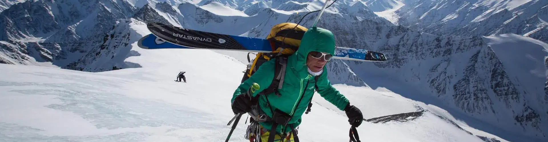
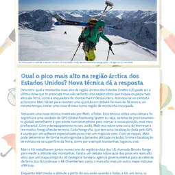
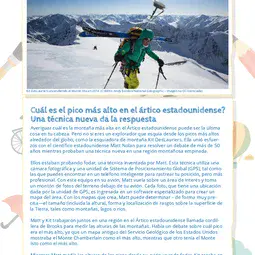
Finding out which is the highest mountain in the US Arctic may be the last thing on your mind. But not if you are an explorer who skis from the tallest peaks around the globe, like ski mountaineer Kit DesLauriers. She joined forces with US scientist Matt Nolan to settle a debate of more than 50 years, while testing a new technique in a steep mountainous region. They were testing fodar, a technique invented by Matt. It uses a photography camera and a Global Positioning System (GPS) unit, like the one you can find on a smartphone to track your location but more professional. With this equipment in his plane, Matt flies over an area of interest and takes lots of photos of the terrain below. Each photo, which has a location given by the GPS unit, is fed into specialised software to create a map of the area. With the maps he creates, Matt can determine – very accurately – the size (including height), shape and location of features on the Earth’s surface, such as mountains, lakes or rivers. Matt and Kit worked together in a region in the US Arctic called Brooks Range to measure the heights of mountains. There was debate on which peak was tallest, since one old map from the US Geological Survey indicated Mt Chamberlain as the highest, while another had Mt Isto as the tallest. While Matt measured the peak heights from his plane using fodar, Kit was on land climbing up and skiing down Mt Isto and Mt Chamberlain with a GPS unit like the one Matt has on his plane. This meant they could compare their height measurements. In this way, they verified that fodar is great to accurately determine mountain height. And they also settled an old debate: at 2735.6m, Mt Isto is the tallest peak in the US Arctic!Find out more
Discuss with your teacher or parents
How are mountains formed? What is GPS and what can it be used for?
With the help of an adult, explore the Fairbanks Fodar website (fairbanksfodar.com), which explains in more detail the technique Matt created. Think about what fodar can be used for and discuss the various uses of this technique with your parents or in your classroom.
Print version
This is a kids' version of the EGU article: 'What’s the highest peak in US Arctic? New technique gives the answer'. It was written by Bárbara Ferreira (EGU Media and Communications Manager), reviewed for scientific content by Matt Nolan (Glaciologist at University of Alaska Fairbanks, US) and Kit DesLauriers (The North Face’s Professional Athlete team, US), and for educational content by Marina Drndarski (Biology Teacher at the Drinka Pavlovic secondary school, Belgrade, Serbia).
Translations


All English-language Planet Press releases are carefully edited, reviewed and proofed, by scientists, educators and EGU staff. Please note that once translated, Planet Press releases receive no further checks from EGU staff. For this reason, we cannot guarantee their accuracy, though we trust the quality of our voluntary translators and are grateful for their work.